Aerial Photo
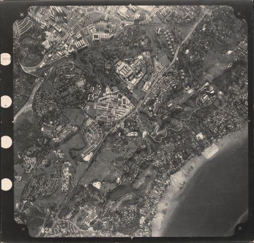
PART OF A SERIES OF AERIAL PHOTOGRAPHS FROM EAST TO WEST SHOWING: MARINE PARADE LAND RECLAMATION, SUNGEI KALLANG, SINGAPORE RIVER, FORT CANNING, PASIR PANJANG, JURONG
Frame centers around modern day NUS/Science Park locality. South Bouna Vista road can be seen meandering across Kent Ridge top center of frame. Main road from bottom right to top right is Ayer Rajah Road.
1970s
20130002384 - 0026
264797
Viewing permitted. Use and reproduction only with permission.
Aerial photographs by the British Royal Air Force between 1940 to 1970s, from a collection held by the National Archives of Singapore. Crown copyright.
Updated with contributions by Chuah Yeow Chong on 13 January 2022.
Do you have more information on this record?
Processing of requests may require 3-5 working days
