MAP
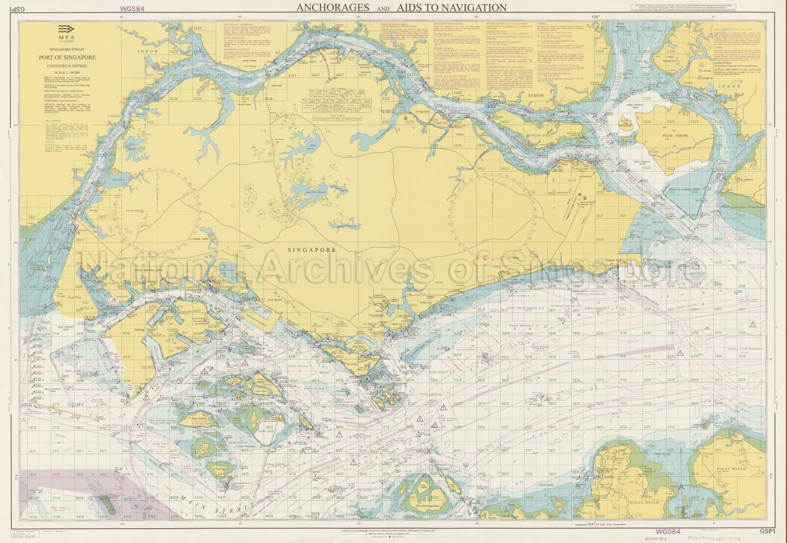
Hydrographic Chart
HC000914
Anchorages And Aids To Navigation
19/07/2007
Chart serves as notices to mariners showing sea charts, depth of water, clarity of water, deep water route, traffic crossing, anchorages, shoals, fairways, submarine cables and pipelines, main expressways on Singapore Island with Second Link and the Causeway, and others
20120001413 - 0004_HC000914
GSP1 WGS84 2nd Edition
English
Published by Hydrographic Department, Maritime and Port Authority of Singapore
First published on 3 Jan 2007
First published on 3 Jan 2007
Viewing permitted. Use and reproduction require written permission from copyright owner.
Seek permission from MPA for reproduction
Processing of requests may require 3-5 working days
