MAP
Hydrographic Chart
HC000335
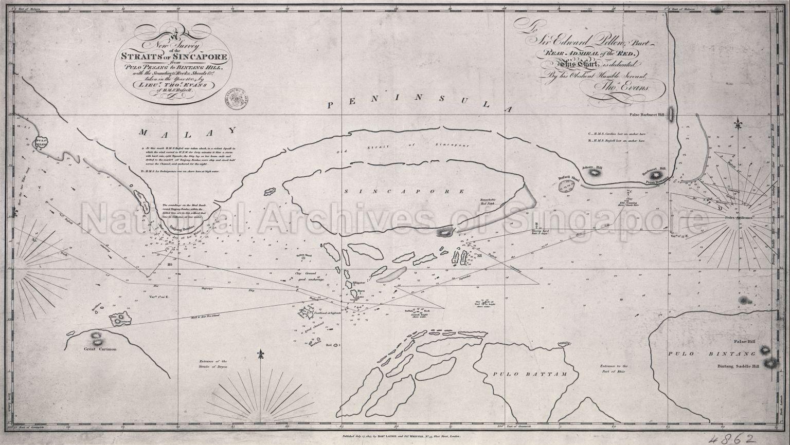
New Survey of the Straits of Singapore from Pulo Pesang to Bintang Hill
27/07/1807
New Survey of the Straits of Singapore from Pulo Pesang to Bintang Hill, with the Soundings, Rocks, Shoals etc. taken in the year 1804 by Lieut. Tho Evans of H.M.S.Rufsell
A British survey of the Straits of Singapore, taken in 1804 and published in 1807. The shape and size of Singapore and its surrounding islands were not accurately known until after the British East India Company, under Sir Stamford Raffles established a trading post on the island in 1819.
A British survey of the Straits of Singapore, taken in 1804 and published in 1807. The shape and size of Singapore and its surrounding islands were not accurately known until after the British East India Company, under Sir Stamford Raffles established a trading post on the island in 1819.
20120001506 - 0010
MCAL 4862
Rob. Laurie and JA Whittle, London
Application for use (and request for copies) has to be made directly with copyright owner or source.
Any request for use or reproduction of the map, please contact info@nationaalarchief.nl.
Processing of requests may require 3-5 working days
