MAP
Survey Map
SP004064
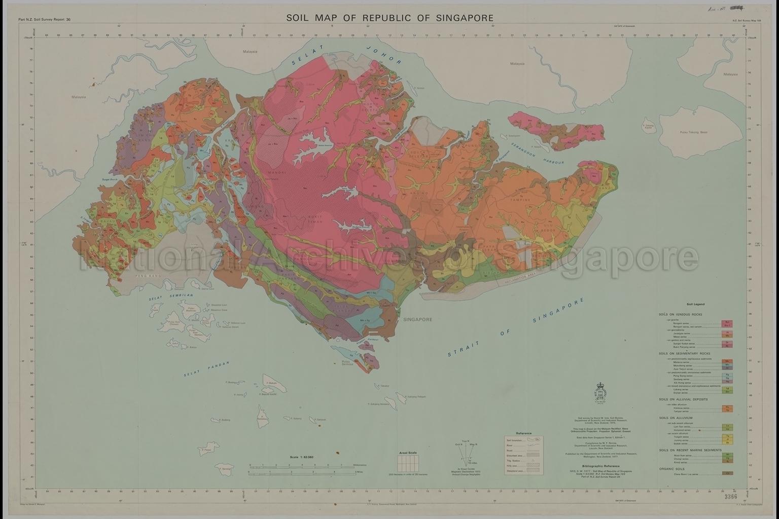
Soil Map Of Republic Of Singapore
1977
Coloured map of Singapore, and its surrounding islands, showing the various soil types (soils of igneous rocks, sedimentary rocks, alluvial deposits, alluvium, marine sediments and organic), places, trigonometrical stations, main roads, reservoirs, rivers, Jurong Industrial Estate, reclamation area, international airport and others
20080000034 - AccNo3366
New Zealand Soil Bureau Map 169
English
Part New Zealand Soil Survey Report 36. Compiled by W.F.Rennie. Drawn by Denise C. Mangnall. F.J.Tindall, Chief Cartographer.
Published by Department of Scientific and Industrial Research, Wellington, New Zealand
E.C. Keating, Government Printers, Wellington, New Zealand
Published by Department of Scientific and Industrial Research, Wellington, New Zealand
E.C. Keating, Government Printers, Wellington, New Zealand
Viewing permitted. Use and reproduction require written permission from copyright owner.
Seek permission from Manaaki Whenua - Landcare Research for use and reproduction by emailing Dan Park, Communications Manager (ParkDJ@landcareresearch.co.nz).
Old accession number: 3366
Credit line: Singapore Land Authority collection, courtesy of National Archives of Singapore
Old accession number: 3366
Credit line: Singapore Land Authority collection, courtesy of National Archives of Singapore
Processing of requests may require 3-5 working days
