MAP
Survey Map
SP003061
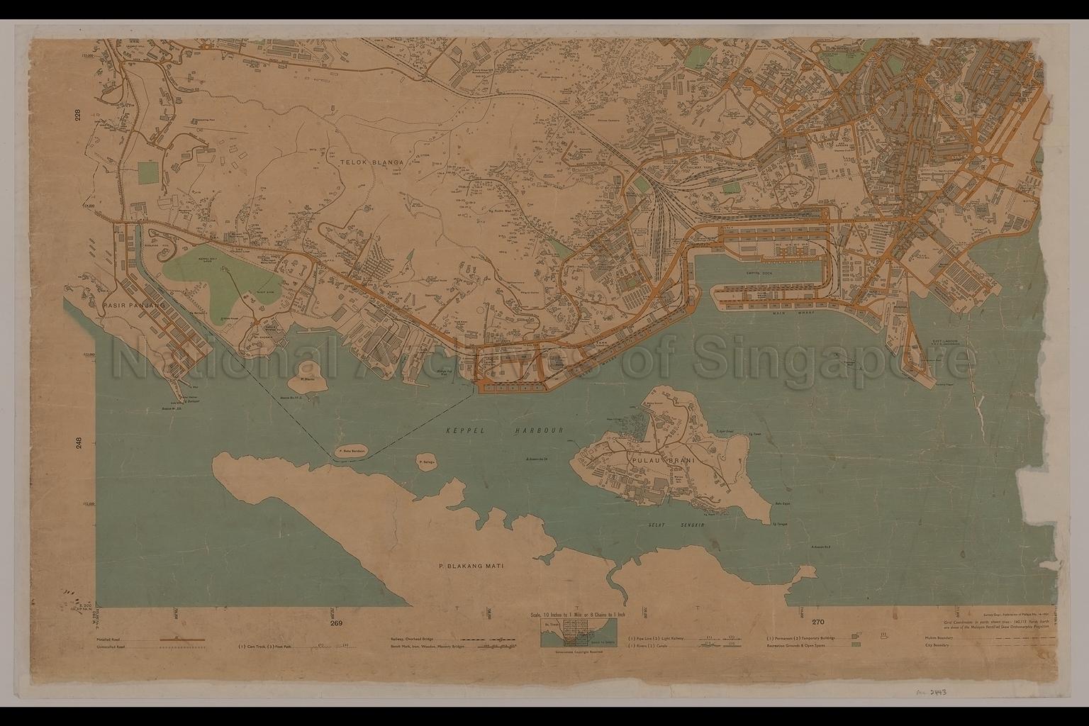
Map of Singapore City
1954
Part Three of map covers Pasir Panjang, and Telok Blangah, showing Mukim boundary, roads, railway, rivers, canals, open spaces, railway yard, buildings, housing estates, fishing village, labour lines, godowns, wharves, margarine factory, rubber factories, schools, temples, mosques, Carmelite Monastery, Singapore Harbour Board Flats, Duxton Plain, Kampong Radin Mas, Saga Village, Berlayar Hill, Bukit Chermin, Malayan Paint Works, Singapore Free Press, Singapore Glass Manufacturers, Popular Biscuit Factory, Keppel Golf Links, Singapore Railway Station, Empire Dock, Keppel Harbour, Pulau Brani, and others
20080000024 - AccNo2443_3
Survey Department,Federation of Malaya Number 16_1954
Map is in six parts- SP003059 to SP003064.
Similar set of maps found in SP002109_1 to SP002109_4, SP002110 and SP002111; but in different condition
Similar set of maps found in SP002109_1 to SP002109_4, SP002110 and SP002111; but in different condition
Survey Department, Federation of Malaya
Government Copyright Reserved.
Government Copyright Reserved.
Viewing permitted. Use and reproduction only with permission.
Old accession number: 2443_3.
Credit line: Singapore Land Authority collection, courtesy of National Archives of Singapore
Credit line: Singapore Land Authority collection, courtesy of National Archives of Singapore
Processing of requests may require 3-5 working days
