Aerial Photo
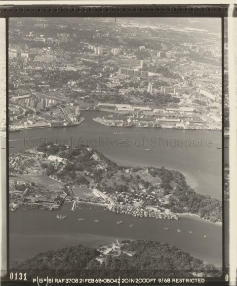
PART OF A SERIES OF AERIAL PHOTOGRAPHS SHOWING TANJONG PAGAR, MOUNT FABER, TANJONG BERLAYER, TUAS, PULAU SAMULUN
This photo shows Pulau Brani in the centre, Sentosa at the bottom (the jetty is Serapong Jetty) and Empire Dock in the background. Tanjong Pagar Railway station is also visible.
21/02/1968
20120001313 - 0059
247559
Viewing permitted. Use and reproduction only with permission.
Aerial photographs by the British Royal Air Force between 1940 to 1970s, from a collection held by the National Archives of Singapore. Crown copyright.
Updated with contributions by Jacob Meyers on 8 June 2023.
Do you have more information on this record?
Processing of requests may require 3-5 working days
