MAP
Survey Map
SP007290
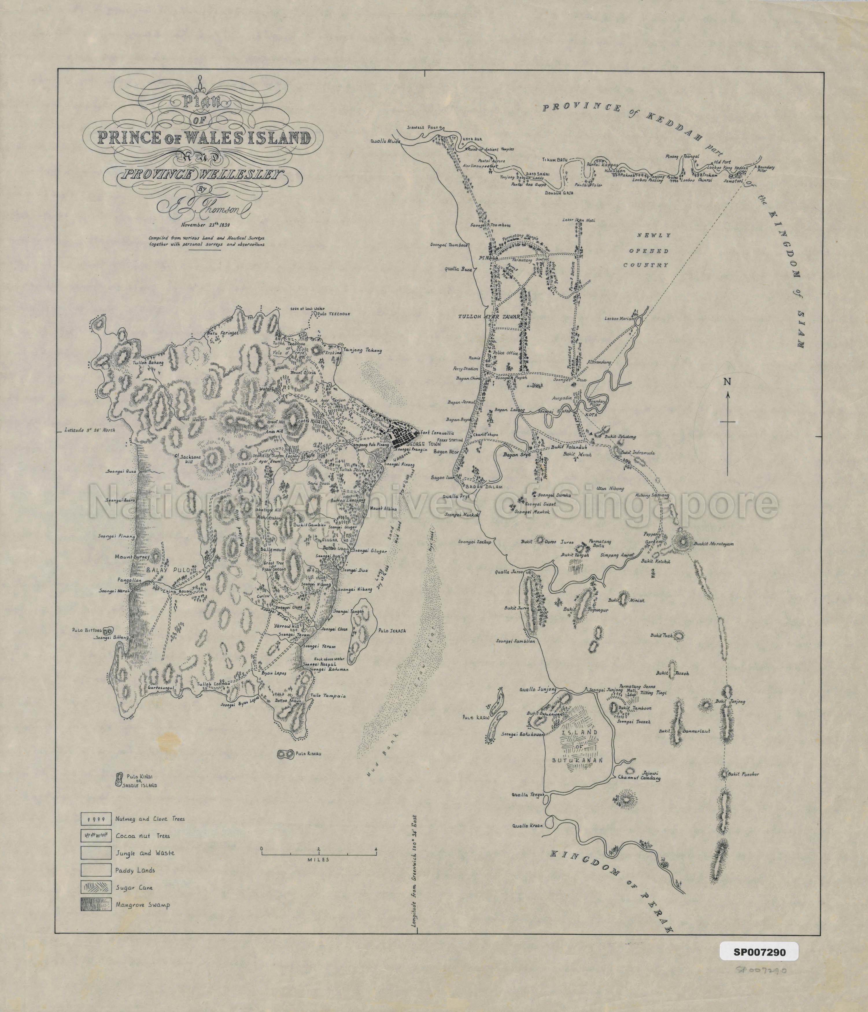
Plan Of Prince Of Wales Island And Province Wellesley
23/11/1839
Map was compiled from various land and nautical surveys together with personal surveys and observations. It shows physical landscape, land use, vegetation, nutmeg and clove trees, coconut trees, rice fields, sugar cane cultivation on Island of Butukawan, mangrove swamp, names of villages, rivers and streams, mountains, islands, Fort Cornwallis, George Town, Tulloh Ayer Tawar, Bagan Dalam and others
Surveyed by J. T. Thomson. This map was produced in 1839, which was before he was appointed as Government Surveyor,
Surveyed by J. T. Thomson. This map was produced in 1839, which was before he was appointed as Government Surveyor,
20120001411 - 0005_SP007290
English
Ms copy by Poon Puay Kee, University of Singapore on tracing paper
Viewing permitted. Use and reproduction only with permission.
.
Processing of requests may require 3-5 working days
