MAP
Survey Map
SP006578
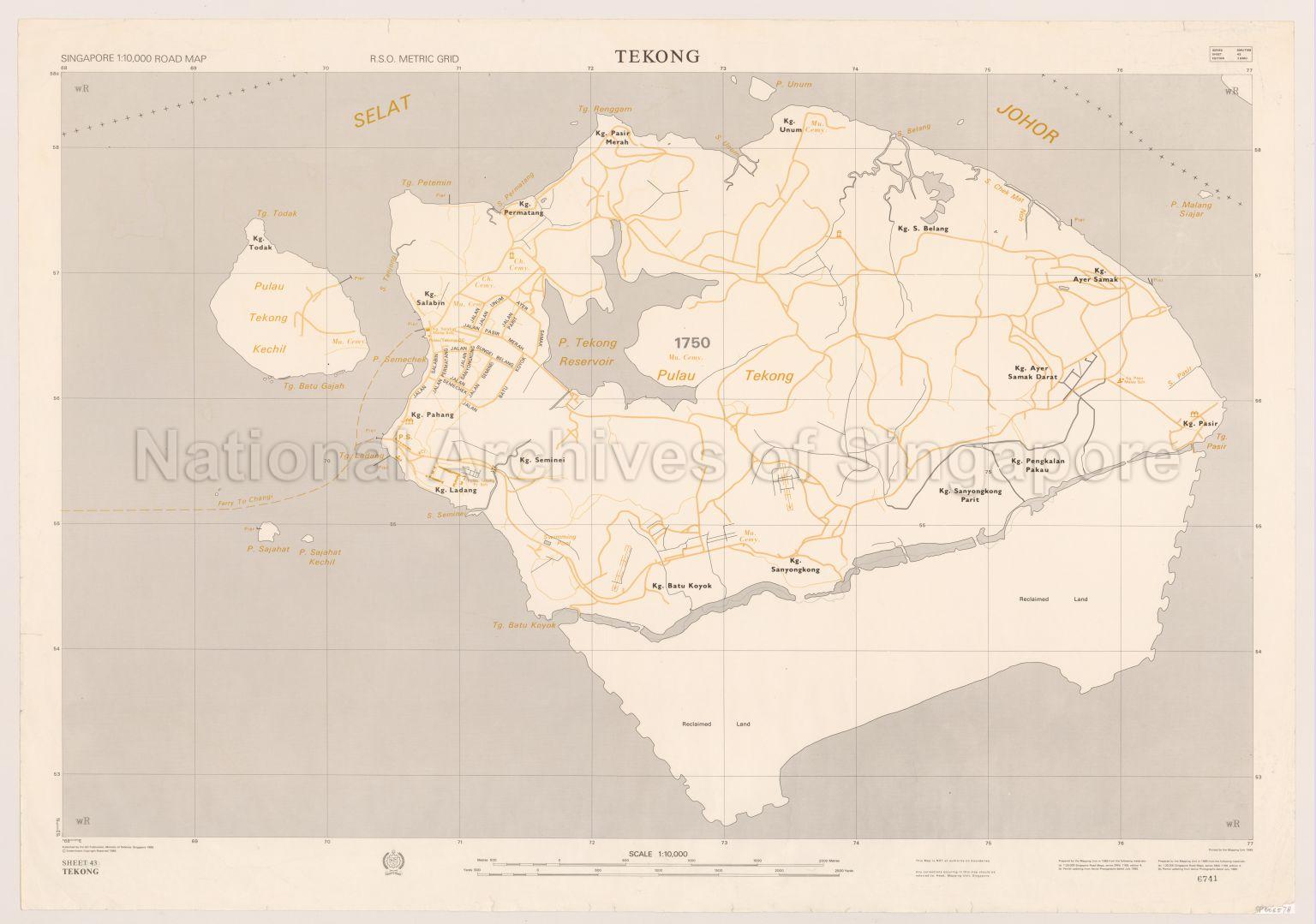
Singapore Road Map. Tekong
1985
Map shows places of worship, schools, police station, swimming pool, cemeteries, piers, ferry route to Changi from Pulau Tekong, reclaimed land, Kampong Pasir, Kampong Pengkalan Pakau, Kampong Sanyongkong Parit, Kampong Sanyongkong, Kampong Batu Koyok, Kampong Seminei, Kampong Ladang, Kampong Pahang, Kampong Salabin, Kampong Permatang, Kampong Pasir Merah, Kampong Unum, Kampong Sungei Belang, Kampong Ayer Samak, Kampong Ayer Samak Darat, Pulau Tekong Kechil, Pulau Sahabat, Johor Strait and others
20120001634 - 0001
SMU 1168 Sheet 43 Edition 3 SMU
English
Published by Officer Commanding, Mapping Unit, Ministry of Defence, Singapore
Viewing permitted. Use and reproduction require written permission from copyright owner.
Seek permission from SLA for reproduction
Processing of requests may require 3-5 working days
