MAP
Hydrographic Chart
HC000624
Singapore Harbour. Plan showing proposed improvements
15/02/1904
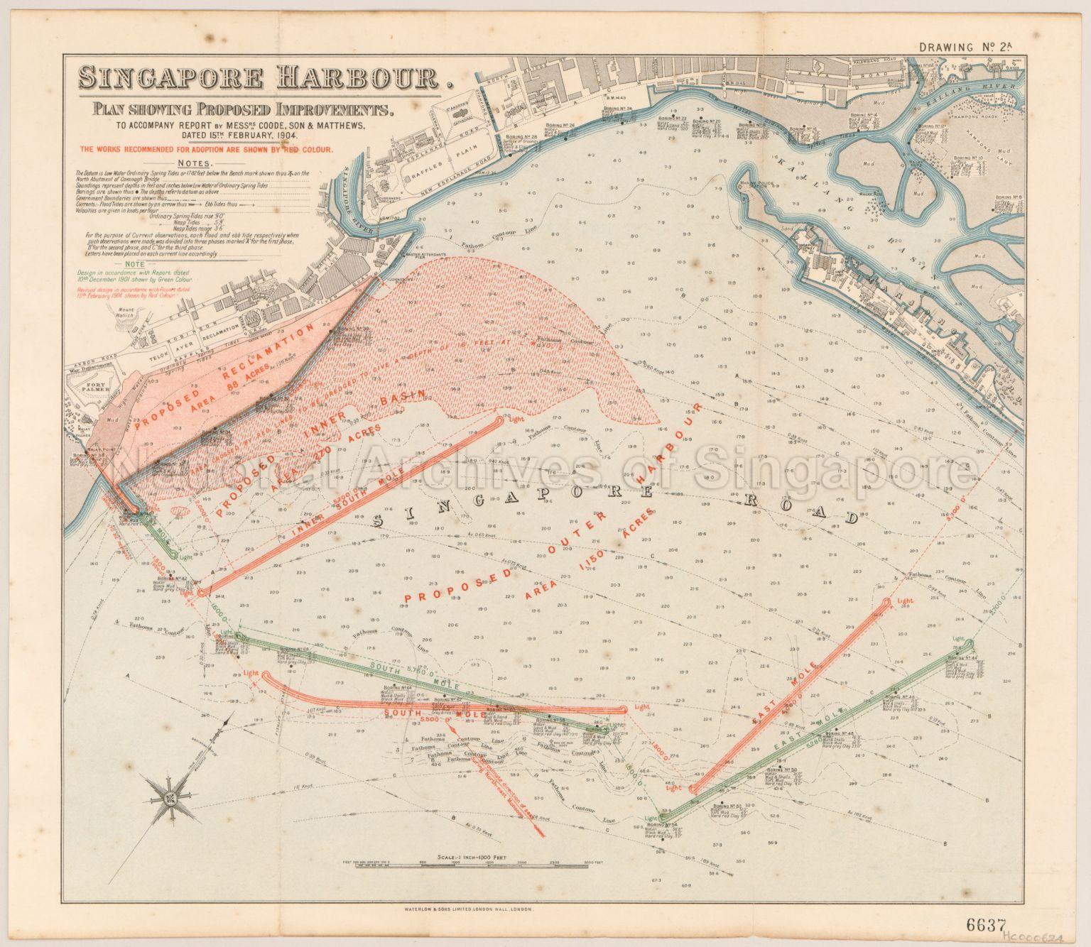
Singapore Harbour. Plan showing proposed improvements. To accompany report by Messrs Goode, Son, and Matthews. A hybrid thematic and hydrographic map showing the soundings and tides at the Singapore Harbour, together with the revised harbour improvement works (in red) proposed by the British governments’ consulting engineer, Coode, Son & Matthews in 1904. The original proposals (in green) were submitted in late 1901. Eventually, only the inner south mole was built, along with part of the land reclamation and dredging works due to technical difficulties, budgetary constraints, and public criticism of the cost of the project.
Map covers Raffles Plain, Kampong Laut, Kallang River, Kallang Basin, Singapore Road, Telok Ayer Reclamation, proposed reclamation, proposed Inner Basin, proposed Inner South Mole, proposed Outer Harbour, South Mole, East Mole, and others
Map covers Raffles Plain, Kampong Laut, Kallang River, Kallang Basin, Singapore Road, Telok Ayer Reclamation, proposed reclamation, proposed Inner Basin, proposed Inner South Mole, proposed Outer Harbour, South Mole, East Mole, and others
20120001551 - 0003
Drawing No.2A
Published by Waterlow and Sons Limited, London Wall, London.
Viewing permitted. Use and reproduction only with permission.
Processing of requests may require 3-5 working days
