MAP
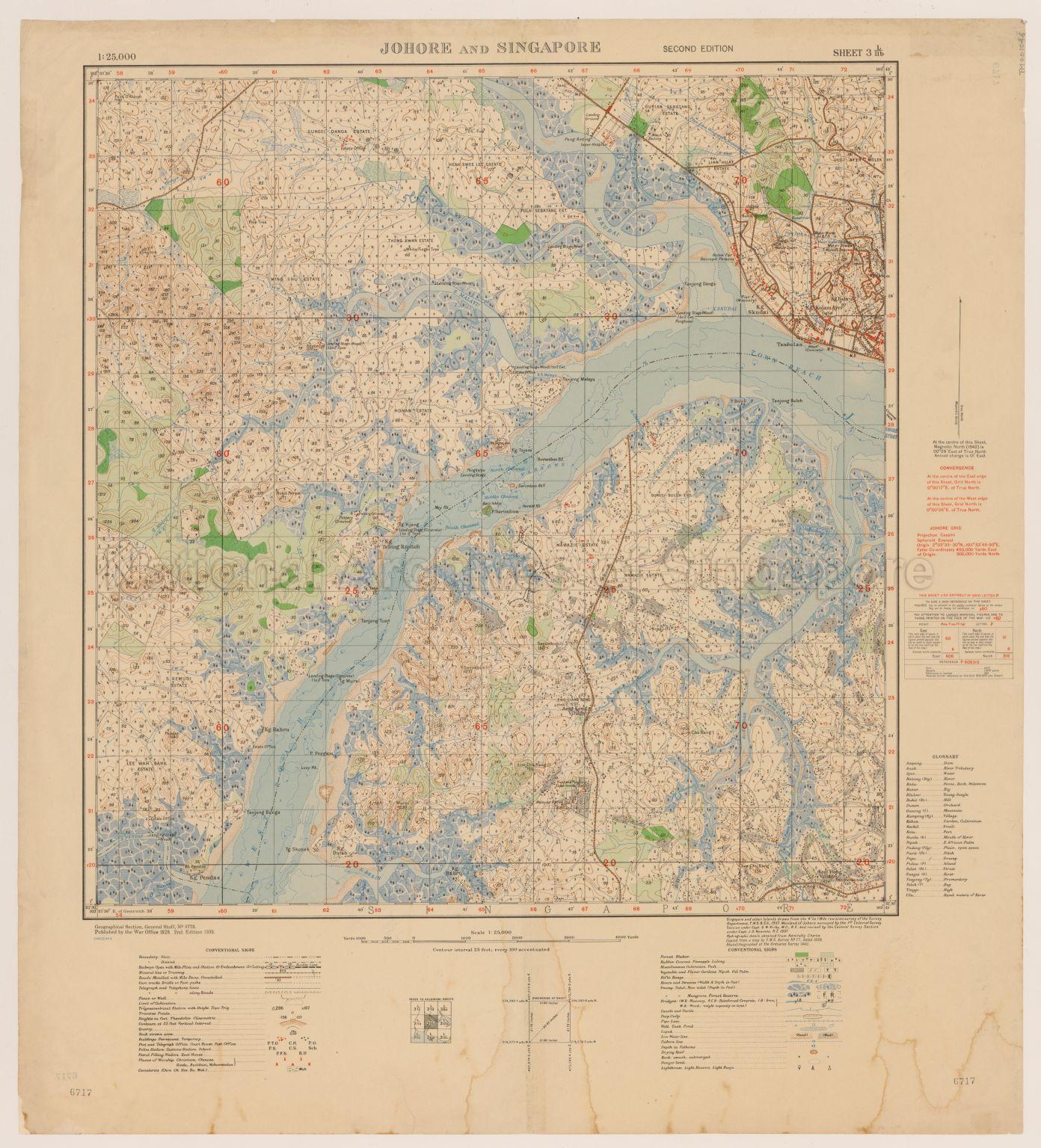
Topographic Map
TM001046
Johore And Singapore
1938
Map shows contours, physical landscape, land use, trigonometrical stations, villages, rubber estates, pineapple plantations, forests, cleared land, vegetable and flower farms, mangrove swamps, water works in Johore, sandbanks, reef, Sungei Buloh Estate, Namazie Estates, Eng Liang Seng Estate, Fruit and Pineapple Experimental Station, Malayan Farming Limited, Ama Keng Village, Keat Hong Village, Sungei Kranji, Sungei Berih, Choa Chu Kang Road, Lim Chu Kang Road, Johore Strait, and others
20120001656 - 0016
Second Edition Sheet 3 L/11b
English
Published by the War Office 1928, Geographical Section, General Staff, No.3772
Viewing permitted. Use and reproduction only with permission.
Processing of requests may require 3-5 working days
