MAP
Hydrographic Chart
HC000717
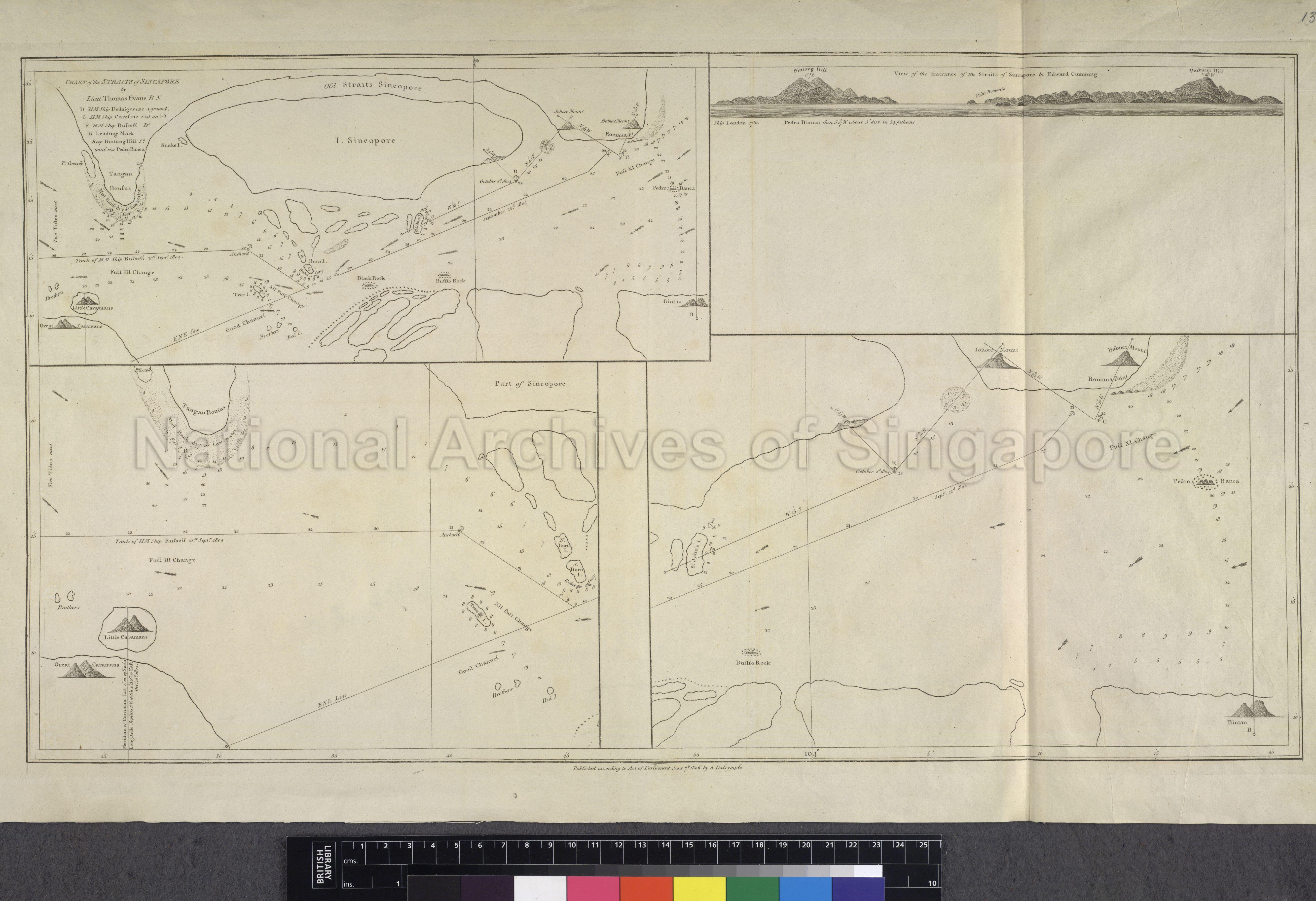
Chart Of The Straits Of Singapore by Lieut. Thomas Evans R.N.
07/06/1806
Chart of the Straits of Singapore
1st inset: Map showing I. Sincopore (Island of Singapore), Old Straits Sincopore, Bintan, Bufflo Rock, Black rock and its surroundings. 2nd Iset: Showing view of the entrance of the Straits of Sincopore by Edward Cumming. 3rd Inset: Map showing Tangan Boulus, part of Sincopore, little and great Caramans and its surroundings. 4th Inset: Map showing St John's Island, Johore Mount, Romana Point, Pedro Branca, Bintan Rock and its surroundings
1st inset: Map showing I. Sincopore (Island of Singapore), Old Straits Sincopore, Bintan, Bufflo Rock, Black rock and its surroundings. 2nd Iset: Showing view of the entrance of the Straits of Sincopore by Edward Cumming. 3rd Inset: Map showing Tangan Boulus, part of Sincopore, little and great Caramans and its surroundings. 4th Inset: Map showing St John's Island, Johore Mount, Romana Point, Pedro Branca, Bintan Rock and its surroundings
PCDM000148 - 0006_c2582-06_HC000717
c2582-06
Published according to Act of Parliament by A.Dalrymple
Application for use (and request for copies) has to be made directly with copyright owner.
Copies and reproductions can only be made for the purpose of educational/academic research, private study and scholarship with proper citation of The British Library (BL) as the original source. Any other uses or commercial uses such as illustrative use in publications such as books, magazines or online, or in exhibition displays require permission from The British Library and this will involve a permission fee and correct citation. To use the map in this context, please complete the online application form at http://www.bl.uk/reshelp/atyourdesk/permissions/permission.html or contact BL’s Permissions department at permissions@bl.uk
Processing of requests may require 3-5 working days
