MAP
Hydrographic Chart
HC000682
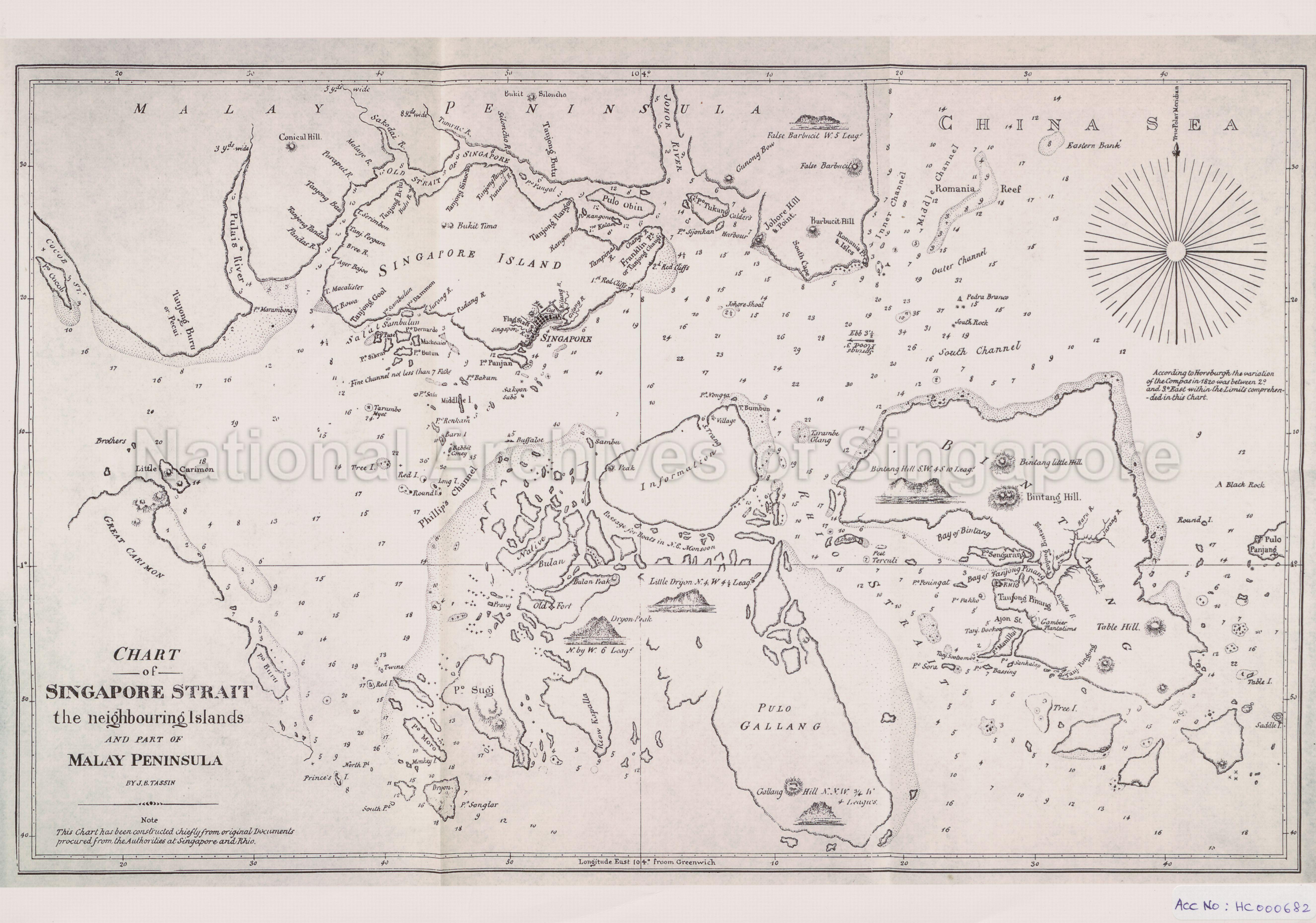
Chart of Singapore Strait the neighbouring Islands and Part of Malay Peninsula
1837
Tassin labels the Governor’s Strait as “Phillip‘s Channel”, while the Johor Strait is erroneously labelled as “Old Strait of Singapore”. This map was based on Daniel Ross’s 1830 chart, which was drafted from marine surveys Ross undertook in 1827.
20140000012 - 0003_HC000682
J.B. Tassin
Application for use (and request for copies) has to be made directly with copyright owner.
Copies and reproductions can only be made for the purpose of educational/academic research, private study and scholarship with proper citation of The British Library (BL) as the original source. Any other uses or commercial uses such as illustrative use in publications such as books, magazines or online, or in exhibition displays require permission from The British Library and this will involve a permission fee and correct citation. To use the map in this context, please complete the online application form at http://www.bl.uk/reshelp/atyourdesk/permissions/permission.html or contact BL’s Permissions department at permissions@bl.uk
Processing of requests may require 3-5 working days
