MAP
General Map
GM000476
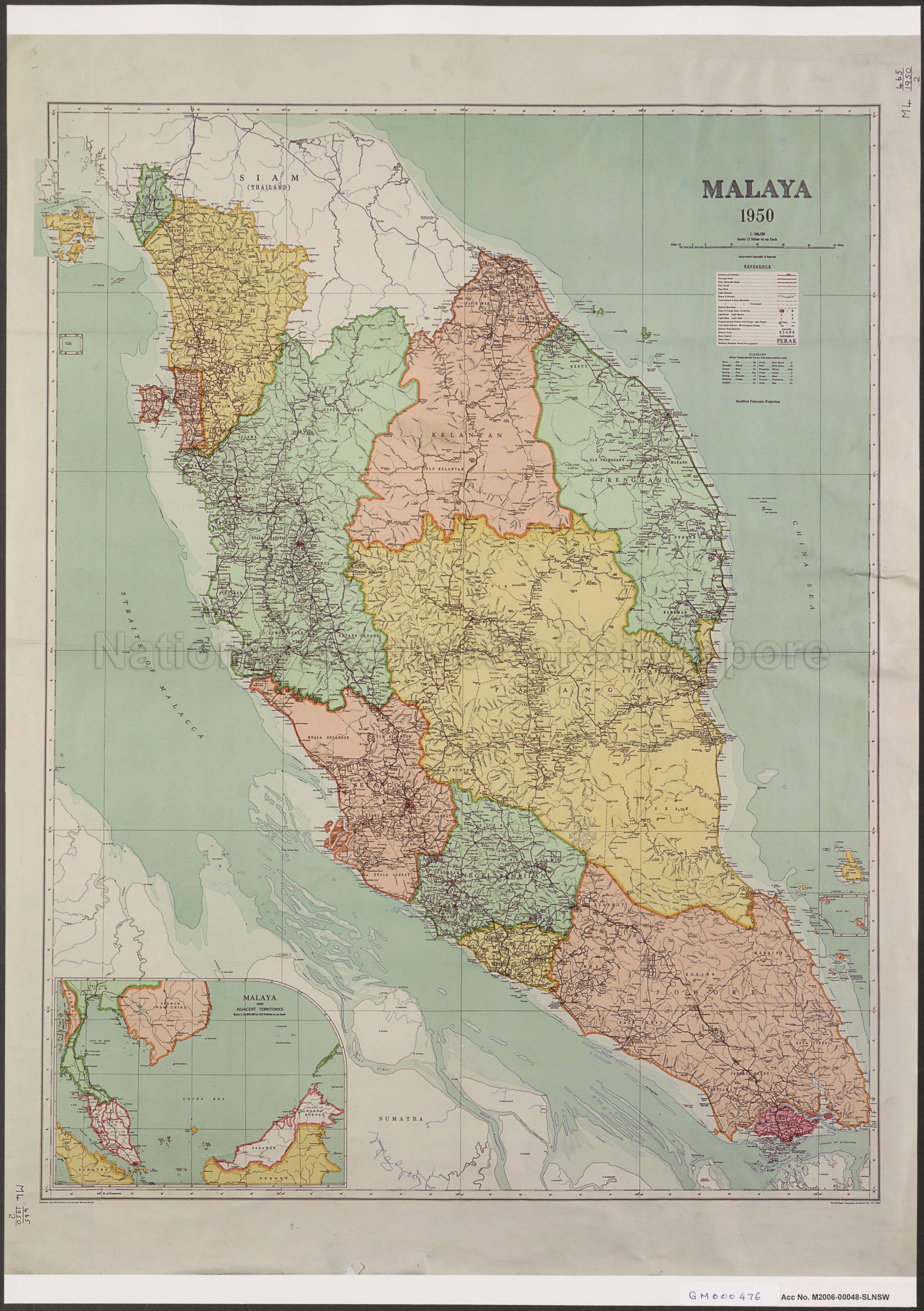
Malaya, 1950
1950
Map covers Peninsula Malaya, and Singapore, showing state boundaries, rivers, names of major towns and villages, and others. Inset: Malaya and Adjacent Territories
20140000009 - 0002_GM000476
M4 465/1950/2
English
Survey Department, Federation of Malaya, No. 131-1949
Application for use (and request for copies) has to be made directly with copyright owner.
Processing of requests may require 3-5 working days
