MAP
General Map
GM000494
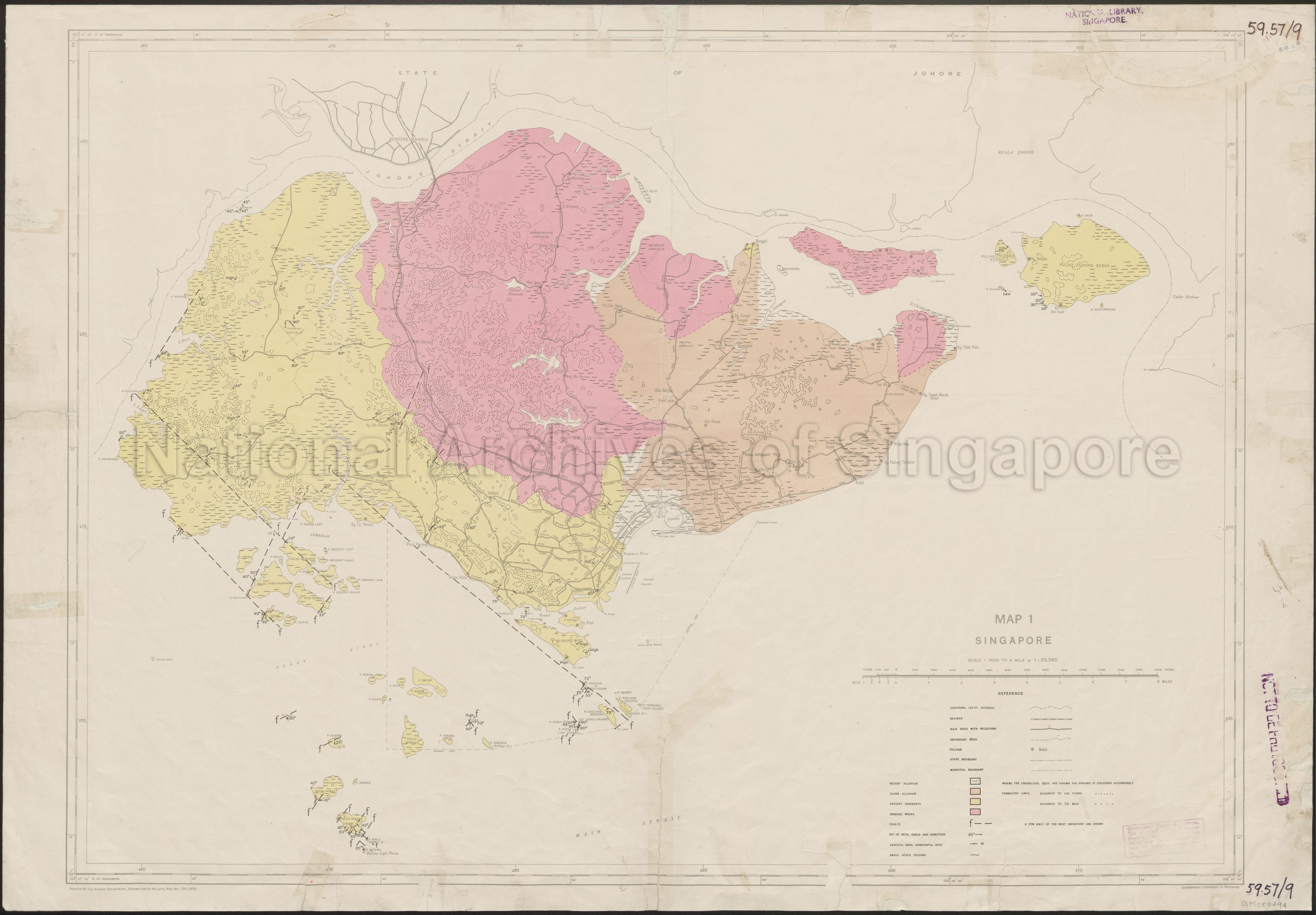
Map 1 Singapore
1950
Map 1 Singapore
Covers the geological landscape of Singapore showing types of rock sediments, district boundaries, roads, railway, villages, rivers, reservoirs, Pulau Ubin, Pulau Tekong Besar, Pulau Blakang Mati, Southern Islands, and others
Covers the geological landscape of Singapore showing types of rock sediments, district boundaries, roads, railway, villages, rivers, reservoirs, Pulau Ubin, Pulau Tekong Besar, Pulau Blakang Mati, Southern Islands, and others
20140000009 - 0015_GM000494
(59.57/9) Survey Department, Federation of Malaya 150-1950
Survey Department, Federation of Malaya
Viewing permitted. Use and reproduction require written permission from copyright owner.
Seek permission from SLA for reproduction
Processing of requests may require 3-5 working days
