MAP
Survey Map
SP006353
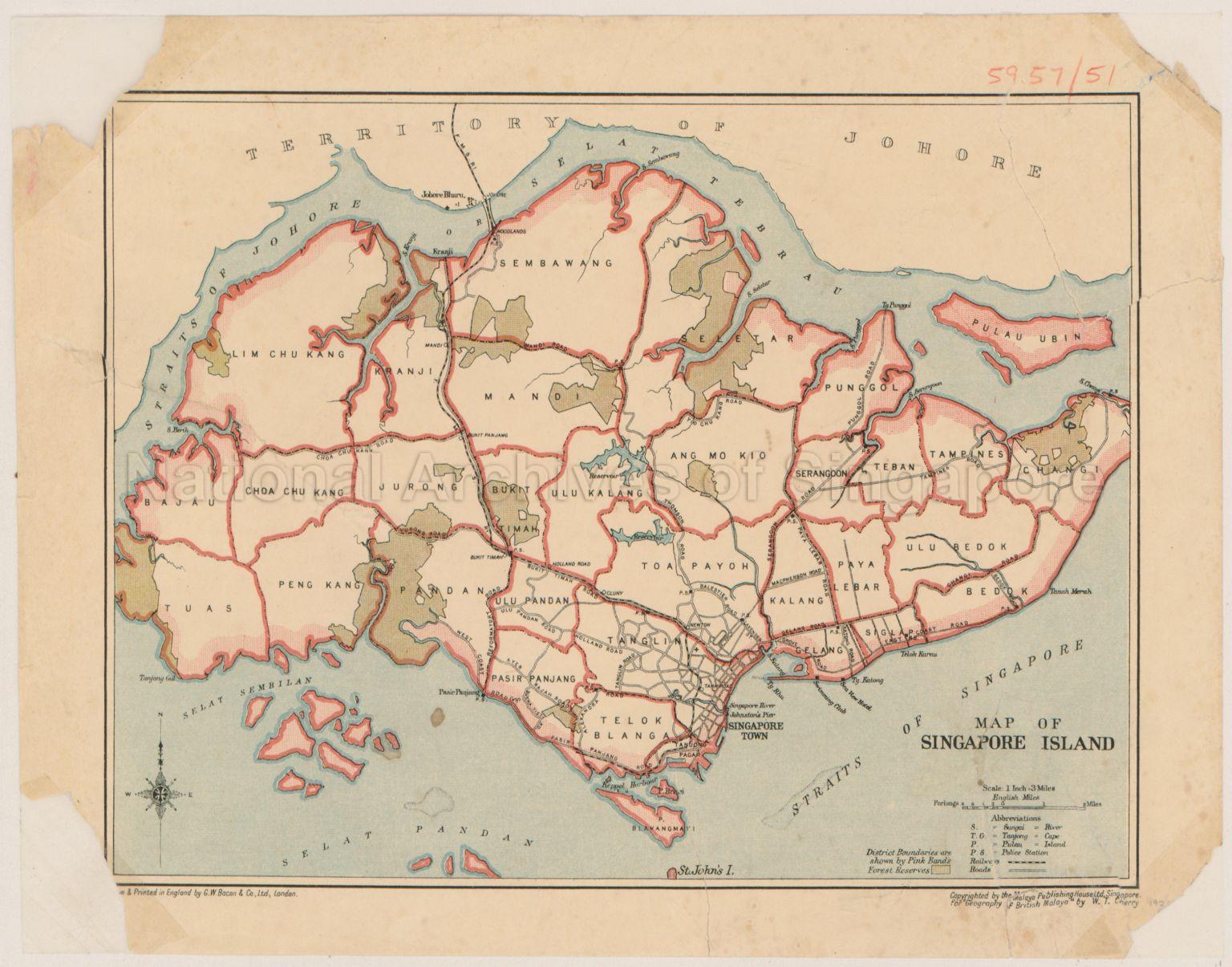
Map Of Singapore Island
1923
Map shows district boundaries, forest reserves, main roads, railway, reservoirs, Tanjong Pagar, Johnston's Pier, Singapore River, Lim Chu Kang, Kranji, Sembawang, Seletar, Mandai, Bajau, Tuas, Choa Chu Kang, Peng Kang, Pandan, Jurong, Bukit Timah, Ulu Pandan, Pasir Panjang, Telok Blangah, Tanglin, Singapore Town, Toa Payoh, Ulu Kalang, Ang Mo Kio, Punggol, Serangoon, Teban, Tampines, Changi, Ulu Bedok, Bedok, Siglap, Kallang, Geylang, and others
20120001613 - 0002
National Library Collection 59.57/51
English
Printed in England by G. W. Bacon And Company Limited, London
Copyrighted by the Malaya Publishing House Ltd, Singapore for the Geography of British Malaya by W.T. Cherry
Copyrighted by the Malaya Publishing House Ltd, Singapore for the Geography of British Malaya by W.T. Cherry
Viewing permitted. Use and reproduction only with permission.
Processing of requests may require 3-5 working days
