MAP
Survey Map
SP006350
Singapore
1945
Singapore
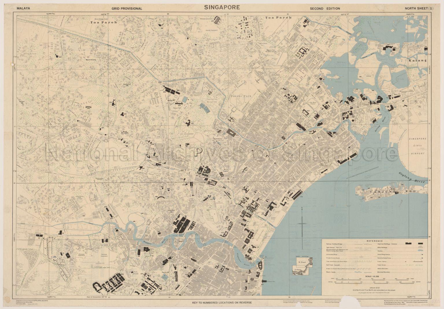
Map covers Toa Payoh and Kallang showing boundaries, buildings, bungalows, schools, hospitals, sports grounds, bridges, roads, railway, vegetation, sewage works, blachan factory, oil factory, steam laundary, Chinese temples, godowns, Chinese cemeteries, Christian cemeteries, Jewish cemeteries, Mohammedan cemeteries, Hindu cemeteries, Manor House, Eu Villa, Pavilion Cinema, Barabantia Hotel, Singapore Improvement Trust Houses, Swiss Cottage Estate, Dalvey Estate, Nassim Hill, Mount Victoria, Goodwood Hill, Mount Emily, Mount Elizabeth, Institution Hill, Pearl's Hill, Seton Close, Chionh ke hu Park, Farrer Park, Jalan Besar Stadium, Mount Sophia, Fort Canning Reservoir, Teck Lee Ice Works, Dalhousie Monument, Cenotaph, Esplanade, Pulau Saigon, Singapore River, Rochor River, Geylang River, Sungei Whompoe, Clifford Pier, and others
Map covers Toa Payoh and Kallang showing boundaries, buildings, bungalows, schools, hospitals, sports grounds, bridges, roads, railway, vegetation, sewage works, blachan factory, oil factory, steam laundary, Chinese temples, godowns, Chinese cemeteries, Christian cemeteries, Jewish cemeteries, Mohammedan cemeteries, Hindu cemeteries, Manor House, Eu Villa, Pavilion Cinema, Barabantia Hotel, Singapore Improvement Trust Houses, Swiss Cottage Estate, Dalvey Estate, Nassim Hill, Mount Victoria, Goodwood Hill, Mount Emily, Mount Elizabeth, Institution Hill, Pearl's Hill, Seton Close, Chionh ke hu Park, Farrer Park, Jalan Besar Stadium, Mount Sophia, Fort Canning Reservoir, Teck Lee Ice Works, Dalhousie Monument, Cenotaph, Esplanade, Pulau Saigon, Singapore River, Rochor River, Geylang River, Sungei Whompoe, Clifford Pier, and others
20120001612 - 0008
V59.57/27 North Sheet (1)
War Office, 1945.Geographical Section, General Staff, No. 4476
Viewing permitted. Use and reproduction only with permission.
Processing of requests may require 3-5 working days
