MAP
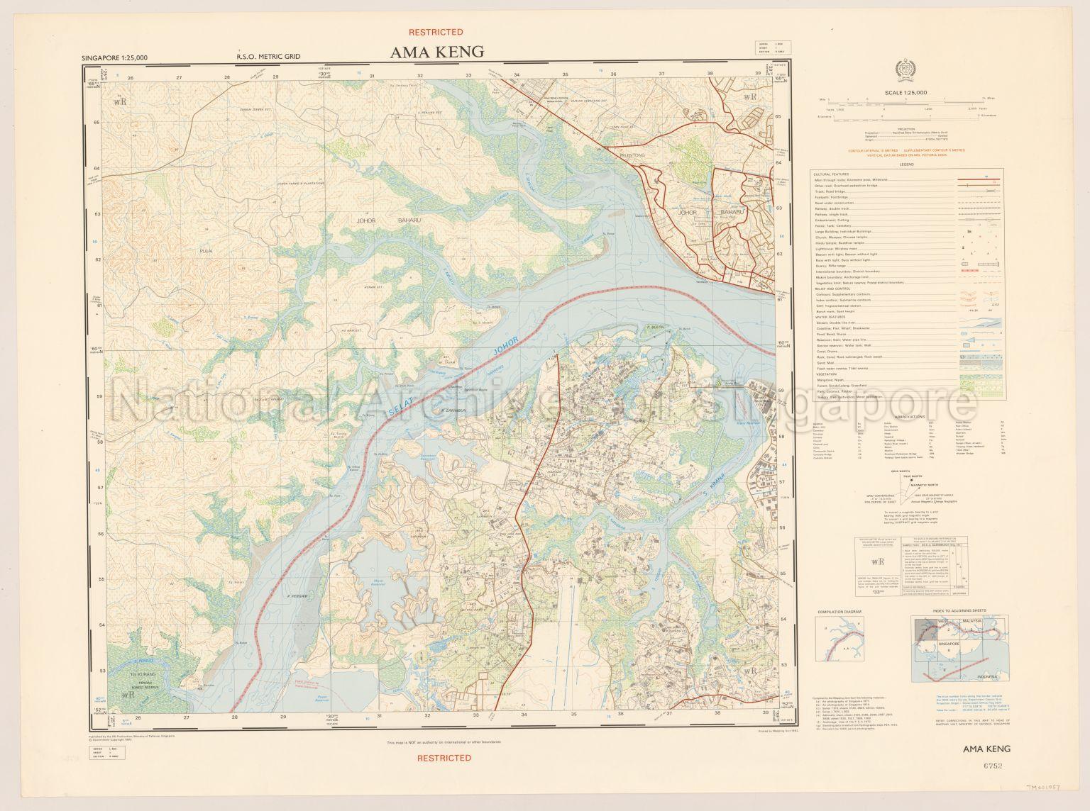
Topographic Map
TM001057
Singapore. Ama Keng
1982
Map showing contours, international boundary, Selat Johor, physical landscape, land use, postal districts boundaries, resettlement area, cleared land, schools, community centres, rubber estates, trigonometrical stations, sandbanks, bushes, ponds, mangrove swamps, Veterinary Station, Malayan Farm, Kranji Dam, Kranji Park, Kranji Industrial Estate, Chinese cemeteries, Chua Chu Kang Road, Ama Keng Road, Neo Tiew Road, Lim Chu Kang Road, and surroundings
20120001657 - 0011
L 802 Sheet 1 Edition 5 SMU Copyright@1982
English
Published by the SO Publication, Ministry of Defence, Singapore
Government Copyright Reserved
Government Copyright Reserved
Viewing permitted. Use and reproduction require written permission from copyright owner.
Processing of requests may require 3-5 working days
