MAP
Topographic Map
TM000857
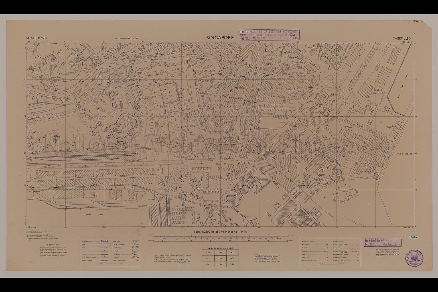
Singapore. Instrumental Plot - Tanjong Pagar
1970
Map shows contours, buildings, community centres, markets, godowns, Telok Ayer Basin, Trafalgar School, Gan Eng Seng Secondary School, Singapore Polytechnic, Singapore Asian Seamen's Club, Singapore Conference Hall, Custom House, Connell House, Hotel Biltmore, Ritz Hotel, Saint Andrew's Mission Hospital, Parsee Burial Ground, Duxton Plain Park, Spottiswoode Park, Yan Kit Swimming Pools, Singapore Railway Station, Empire Dock, Neil Road, Cantonment Road, Hoe Chiang Road, Tanjong Pagar Road, Tras Street, Keppel Road, Tanjong Pagar Road, Anson Road, Shenton Way, South Quay, and others
The building indicating "Central Provident Fund Board" is likely erroneous and belongs to the Anson Centre instead. At that time, CPF Board Building was at 79 Anson Road, which is the junction between Anson Road and Palmer Road; and Anson Centre is at 51 Anson Road, the junction between Anson Road and Parsi Road.
The building indicating "Central Provident Fund Board" is likely erroneous and belongs to the Anson Centre instead. At that time, CPF Board Building was at 79 Anson Road, which is the junction between Anson Road and Palmer Road; and Anson Centre is at 51 Anson Road, the junction between Anson Road and Parsi Road.
20080000023 - AccNo2367
Sheet L23 NAC14/68 SDS446/68/ PT1
Produced by Fairey Surveys Ltd for the Government of Singapore.
Viewing permitted. Use and reproduction require written permission from copyright owner.
Seek permission from SLA for use and reproduction.
Old accession number: 2367
Credit line: Singapore Land Authority collection, courtesy of National Archives of Singapore
Old accession number: 2367
Credit line: Singapore Land Authority collection, courtesy of National Archives of Singapore
Processing of requests may require 3-5 working days
