MAP
Survey Map
SP002981
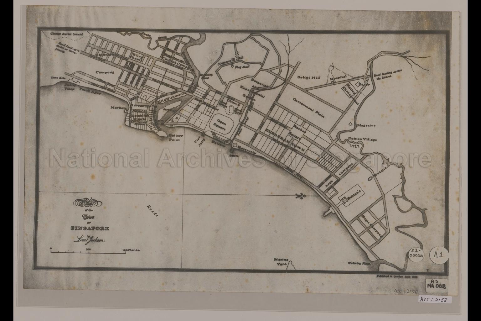
Plan of the Town of Singapore by Lieut Jackson
1828
This proposed plan of Singapore Town prepared by Lieutanent Jackson in line was not actually executed. Map shows land division, Chinese burial ground, lime kiln, fishing village, market, mosque, watering place, pier, jetty, Chinese Kampong, Chuliah Kampong, Bugis Kampong, Dhobies Village, Kling Chapel, European Town, Singapore Hill, Selegie Hill, Rocher Square, Commercial Square, Open Square, Battery Point, Singapore River, Cantonment Plain, Botanical and Experimental Garden and others
20080000020 - AccNo2158
A2Ma0018
Published in London
Sketch by Lieutenant Philip Jackson
Sketch by Lieutenant Philip Jackson
Viewing permitted. Use and reproduction only with permission.
Old accession number: 2158
Credit line: Singapore Land Authority collection, courtesy of National Archives of Singapore
Credit line: Singapore Land Authority collection, courtesy of National Archives of Singapore
Processing of requests may require 3-5 working days
