MAP
Survey Map
SP003001
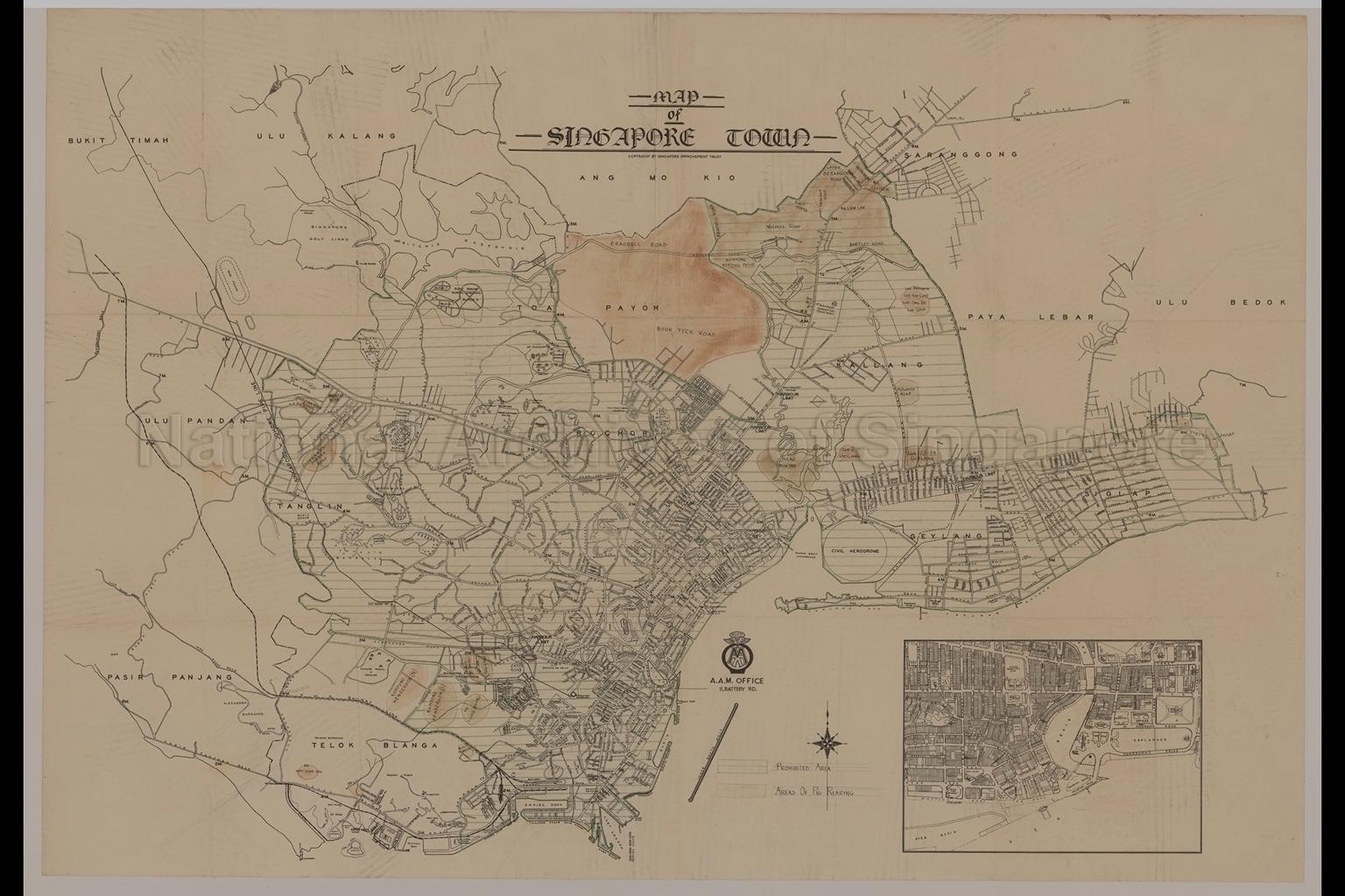
Map Of Singapore Town
c.1950
Map covers Bukit Timah, Ulu Pandan, Tanglin, Pasir Panjang, Telok Blangah, Rochor, Toa Payoh, Ulu Kalang, Ang Mo Kio, Serangoon, Paya Lebar, Ulu Bedok, Kallang, Geylang and Siglap showing roads, milestones, railway lines, buildings, piers, wharves, areas prohibited for pig rearing, pig rearing areas in Kampong Heap Guan San, Kampong Wishart, Kampong Henderson, Kampong Tiong Bahru, Bukit Teresa, Bukit Ho Swee, Beo Lane, Farrer Road, Coronation Road, Duchess Road, Braddell Road, Boon Teck Road, Kampong Potong Pasir, Kampong Liew Lian, Kampong Sireh, Pulau Minyak, Changi, Siglap, and others,
20080000020 - AccNo2174
English
Copyright by Singapore Improvement Trust
Date is estimated
Date is estimated
Viewing permitted. Use and reproduction only with permission.
Old accession number: 2174.
Credit line: Singapore Land Authority collection, courtesy of National Archives of Singapore
Credit line: Singapore Land Authority collection, courtesy of National Archives of Singapore
Processing of requests may require 3-5 working days
