MAP
Survey Map
SP002274
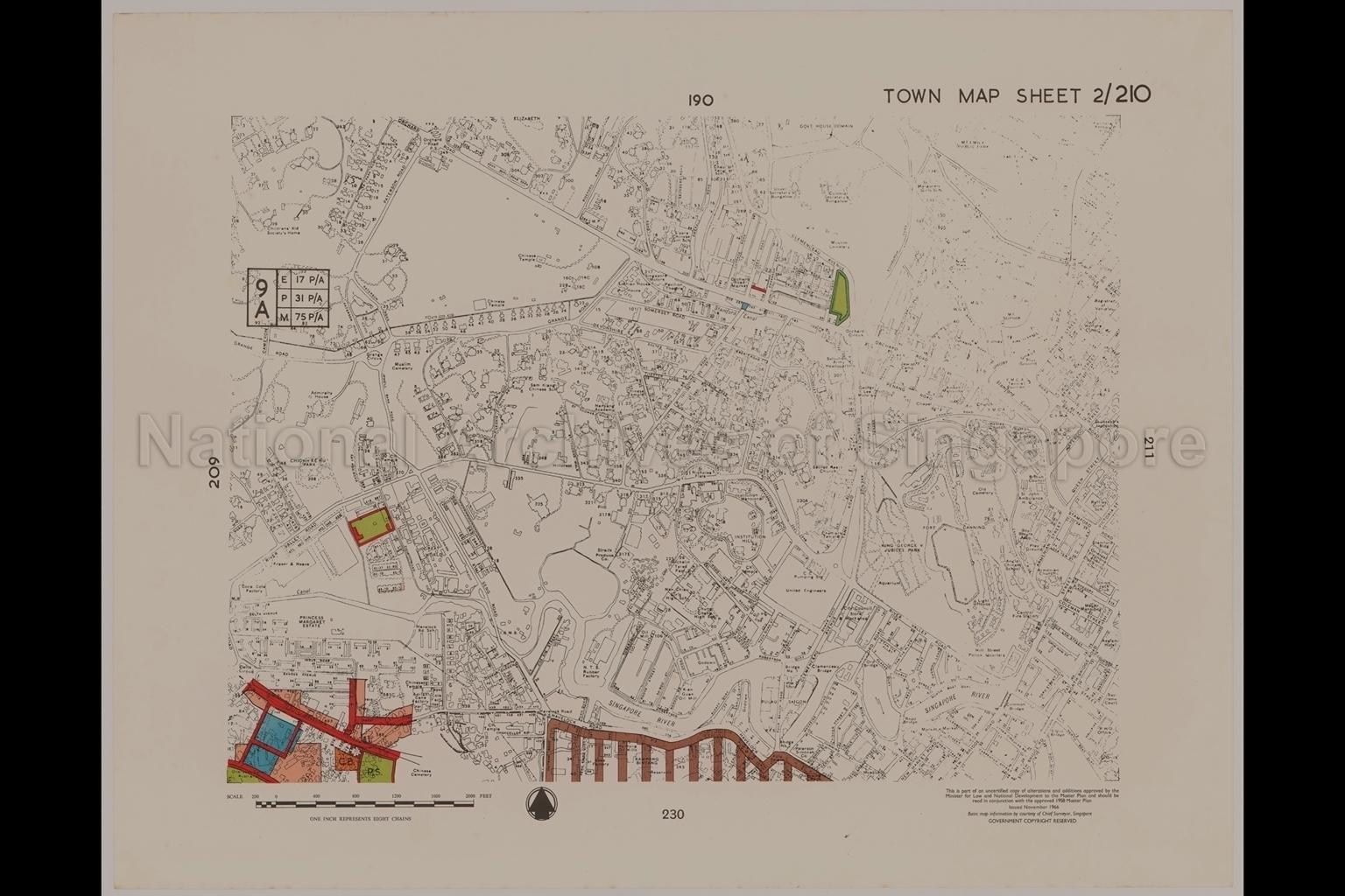
1958 Master Plan - Town Map Sheet 2/210
1966
1958 Master Plan:
Map covers areas Paterson Road/Orchard Road, Grange Road, Killiney Road, Irwell Bank Road, River Valley Road, North Boat Quay, New Bridge Road/Hill Street, South Bridge Road/North Bridge Road, Clemenceau Avenue, Kim Seng Road, Havelock Road, Fort Canning Road, Armenian Street/Queen Street, Waterloo Street, Bencoolen Street, Prinsep Street, Selegie Road/Serangoon Road. It shows Children's Aid Society's Home, Admiralty House off Grange Road, Chionh Ke Ru Park, Princess Margaret Estate, Kampong Bintang, Orchard Road Police Station, Under-Secretary's Bungalow, Colonial Secretary's Bungalow, Government House Domain, Orchard Road Market, Lothian House at Grange Road; Singapore Motors and Pavilion Theatre at Orchard Road, Sam Kiang Chinese School, Nanyang Academy at Saint Thomas Walk; Salvation Army Headquarters at Clemenceau Avenue, Registrar of Vehicles at Middle Road; Coca Cola Factory, Fraser and Neave, Saint Nicholas Flats and Institution Mansion along River Valley Road; Adrian Cane Factory, Pepsi Cola Factory and Ho Hong Oil Mills off Havelock Road; soap factory at Peng Sang Quay, Kian Guan Oil Mill at Hanson Road, oil mill at Robertson Quay, King George V Jubilee Park, aquarium, Old Cemetery and Lighthouse at Fort Canning, Singapore River, Chinese and Muslim cemeteries.
Map covers areas Paterson Road/Orchard Road, Grange Road, Killiney Road, Irwell Bank Road, River Valley Road, North Boat Quay, New Bridge Road/Hill Street, South Bridge Road/North Bridge Road, Clemenceau Avenue, Kim Seng Road, Havelock Road, Fort Canning Road, Armenian Street/Queen Street, Waterloo Street, Bencoolen Street, Prinsep Street, Selegie Road/Serangoon Road. It shows Children's Aid Society's Home, Admiralty House off Grange Road, Chionh Ke Ru Park, Princess Margaret Estate, Kampong Bintang, Orchard Road Police Station, Under-Secretary's Bungalow, Colonial Secretary's Bungalow, Government House Domain, Orchard Road Market, Lothian House at Grange Road; Singapore Motors and Pavilion Theatre at Orchard Road, Sam Kiang Chinese School, Nanyang Academy at Saint Thomas Walk; Salvation Army Headquarters at Clemenceau Avenue, Registrar of Vehicles at Middle Road; Coca Cola Factory, Fraser and Neave, Saint Nicholas Flats and Institution Mansion along River Valley Road; Adrian Cane Factory, Pepsi Cola Factory and Ho Hong Oil Mills off Havelock Road; soap factory at Peng Sang Quay, Kian Guan Oil Mill at Hanson Road, oil mill at Robertson Quay, King George V Jubilee Park, aquarium, Old Cemetery and Lighthouse at Fort Canning, Singapore River, Chinese and Muslim cemeteries.
20050001011 - AccNo336_33
33/40
English
Part of set of 40 maps SP000437 to SP000462 and SP002268 to SP002281
Chief Surveyor, Singapore. Planning Department, Ministry of Law and National Development
Viewing permitted. Use and reproduction require written permission from copyright owner.
Seek permission from URA for reproduction
Processing of requests may require 3-5 working days
