MAP
Survey Map
SP001098
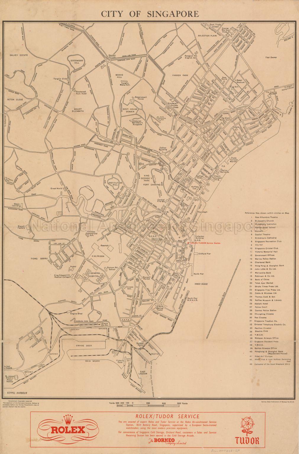
City of Singapore
1952
Map covers the city area showing major places, private buildings, housing estates, cinemas, clubs, hospitals, hotels, monuments, playground, parks, government buildings, prisons, markets, roads, railway line, reservoirs, piers, lagoons, docks, wharves, biscuit factory, steam laundry industry, schools, and rivers such as Raffles Hotel, Goodwood Park Hotel, Maxwell Market, Clyde Terrace Market, Raffles Institution, King George V Park, Farrer Park, Fort Canning, Balestier Plain, Government House Domain, Dalvey Estate, Great World, New World, Cathay Building, Cenotaph, City Gas Works, General Hospital, Kwong Wai Sui Hospital, Rex Cinema, Pavilion Cinema and others. The location of Rolex/Tudor Service Station is indicated in red and advertisement banner printed in red at bottom of map.
20120001573 - 0019
Survey Department, Federation of Malaya No. 60-52
Survey Department, Federation of Malaya
Viewing permitted. Use and reproduction only with permission.
Processing of requests may require 3-5 working days
