MAP
Survey Map
SP001088
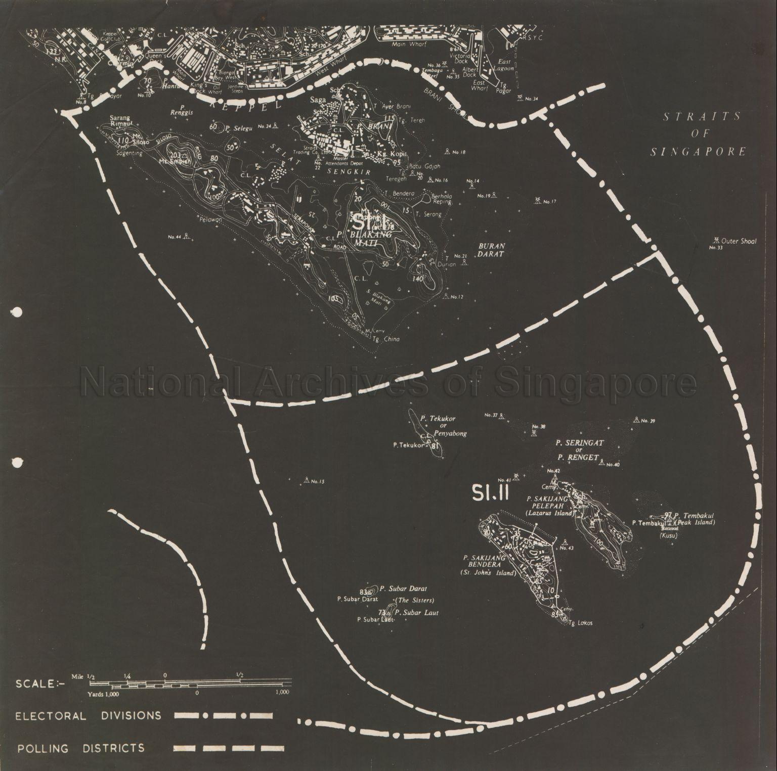
electoral Division of the Southern Islands (SI.I and SI.II)
1959
Map covers the electoral division of the Southern Islands comprising of (SI.I) Pulau Blakang Mati and Pulau Brani and (SI.II) Pulau Sakijang Bendera (Saint John's Island), Pulau Sakijang Pelepah (Lazarus Island), Pulau Tembakul (Peak Island), Pulau Tembakul (Kusu), Pulau Tekukor, Pulau Seringat, Pulau Subar Darat and Pulau Subar Laut (The Sisters), showing electoral divisions boundary, polling districts boundary, physical landscape, buildings, settlements, roads, schools, cemeteries, nature reserves, beacons, Mount Embiah, Mount Siloso, Mount Serapong, Straits Trading Company Limited, Master Attendants Depot, Kampong Kopil and others.
20120001573 - 0009
(50/56)
This is part of a set of 56 maps SP001039 to SP001094
Survey Department, Singapore
Viewing permitted. Use and reproduction require written permission from copyright owner.
Seek permission from SLA for use and reproduction.
Credit line: Singapore Land Authority collection, courtesy of National Archives of Singapore
Credit line: Singapore Land Authority collection, courtesy of National Archives of Singapore
Processing of requests may require 3-5 working days
