MAP
General Map
GM000015
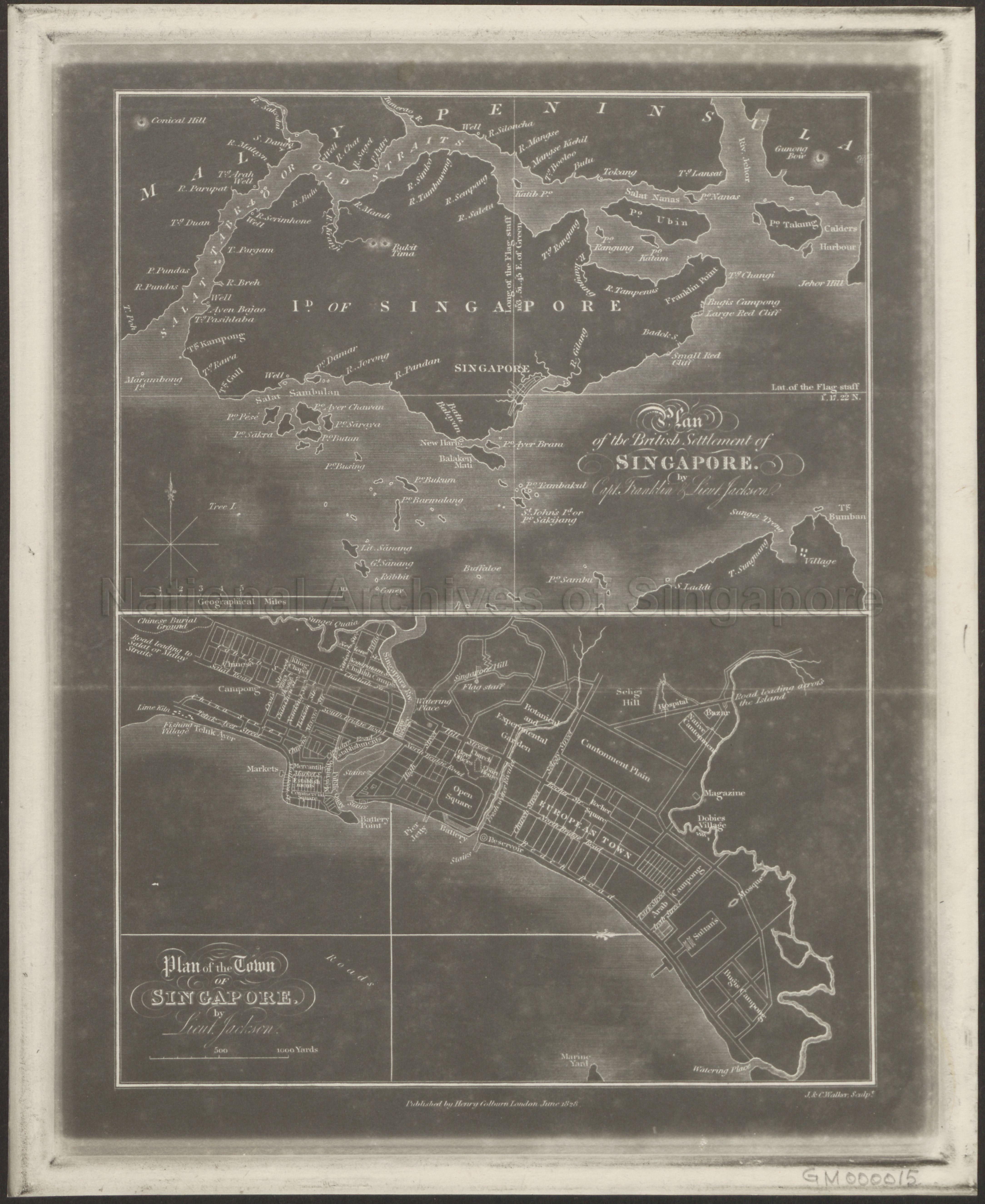
(a) Plan Of The British Settlement Of Singapore By Captain Franklin And Lieut. Jackson (b) Plan Of The Town Of Singapore By Lieut. Jackson
1828
Map A – A reproduction of Capt James Franklin’s map of Singapore. Published in 1828, it was the first map which properly captured the outline of Singapore Island. Map shows Singapore and its islands, part of Pulau Batam and southern part of the Malay Peninsula
Map B- The Jackson Plan for Singapore town, which was published in 1828 is the earliest known plan of the town and was based on Sir Stamford Raffles’s vision for Singapore’s development into a modern, rationally ordered settlement. Map shows Singapore central district showing the Singapore River, various settlements, burial grounds, hills, plain, botanical garden, roads and others
Map B- The Jackson Plan for Singapore town, which was published in 1828 is the earliest known plan of the town and was based on Sir Stamford Raffles’s vision for Singapore’s development into a modern, rationally ordered settlement. Map shows Singapore central district showing the Singapore River, various settlements, burial grounds, hills, plain, botanical garden, roads and others
20140000011 - 0014_GM000015
English
Maps Acc No. GM000014 and Acc No. GM000015 are similar copies. Both are small photographic print of a framed map.
This copy is an image reproduction of page 529 of the following publication:
Title: Journal of an embassy from the Governor-General of India to the courts of Siam and Cochin-China : exhibiting a view of the actual state of those kingdoms
Author: Crawfurd, John, 1783-1868
Published by Henry Colburn, London, 1828
To view the publication, please refer to Lee Kong Chian Reference Library
Viewing permitted. Use and reproduction only with permission.
Credit line: Singapore Land Authority collection, courtesy of National Archives of Singapore
Processing of requests may require 3-5 working days
