MAP
Survey Map
SP001042
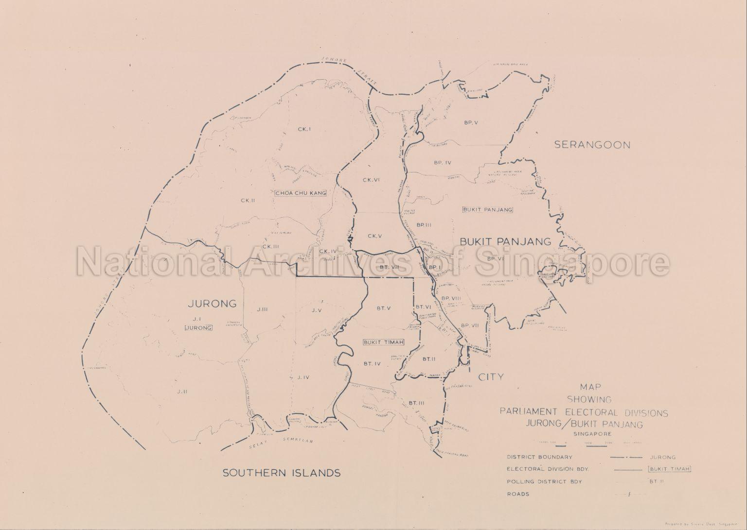
Map Showing Parliament electoral Divisions Jurong/Bukit Panjang, Singapore
1959
Map shows district boundary, electoral division boundary, polling district boundary, roads, railway line, rivers, catchment area, nature reserve, reservoirs, public parks, Nanyang University, His Majesty Naval Base area, electoral divisions of Choa Chu Kang, Jurong, Bukit Timah, Bukit Panjang and Southern Islands.
20120001571 - 0015
(4/56)
This is part of a set of 56 maps SP001039 to SP001094
Survey Department, Singapore
Viewing permitted. Use and reproduction require written permission from copyright owner.
Seek permission from SLA for use and reproduction.
Credit line: Singapore Land Authority collection, courtesy of National Archives of Singapore
Credit line: Singapore Land Authority collection, courtesy of National Archives of Singapore
Processing of requests may require 3-5 working days
