MAP
Survey Map
SP001172
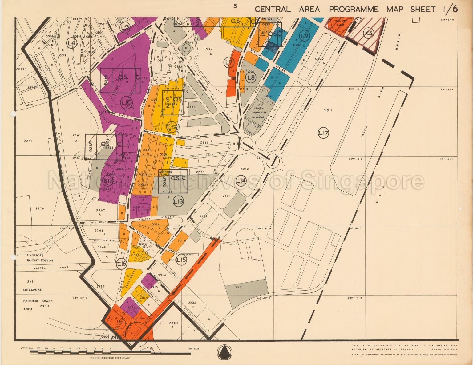
1958 Master Plan: Central Area Programme Map Sheet 1/6
01/04/1958
1958 Master Plan: Map covers unscheduled areas, central area redevelopment boundary and central planning district boundary in areas off Cantonment Road, Neil Road, Craig Road, Bukit Pasoh Road, Keong Saik Road, Teck Lim Road, Banda Street, Duxton Hill, Outram Road, Narcis Street, Yan Kit Road, Cheng Cheok Street, Hoe Chiang Road, Enggor Street, Bernam Street, Sambau Street, Lim Teck Kim Road, Raub Street, Tanjong Pagar Road, Anson Road, Tian Lye Street, Chin Lye Street, Deli Street, Rambau Street, Patani Street, Selangor Street, Trafalgar Street, Siak Street, Palmer Road, Tras Street, Tapah Street, Choon Guan Road, Wallich Street, Maxwell Road, Cecil Street, McCallum Street, Stanley Street, Robinson Road, Shenton Way, Telok Ayer Basin, and the surroundings showing areas not affected by redevelopment, special development areas, stages of development, areas for community requirement such as schools, markets, clinics, community centres and open spaces, Crown leases expired, Singapore Harbour Board area, Singapore Railway Station, Criminal Investigation Department, Telok Ayer Market, and others.
20120001576 - 0021
English
This is part of a set of 71 maps SP001158 to SP001212_1
Uncertified copy of part of the Master Plan approved by the Governor in Council. Basic map information by courtesy of Chief Surveyor.
Viewing permitted. Use and reproduction require written permission from copyright owner.
Seek permission from URA for reproduction
Processing of requests may require 3-5 working days
